Worrall Travel R's

Worrall Travel R's
Roz and Russ

Worrall Travel R's - Kicking the Bucket List

Tuesday, June 04, 2013

Escalante Petrified Forest to Four Corners

Escalante Petrified Forest - Petrified Wood

Tuesday, June 4, 2013 - The Last of Utah

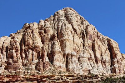
After leaving Bryce Canyon we meandered through beautiful country where the layers of 160 million years were peeled away, exposing high plateaus, and cliffs so old that there were no animal fossils.


We marveled at the petrified forest where trees were fossilized and  between 80 and 100 million years old.  The fossilized minerals shone like gems in the morning light.  Every area we passed through bore the history of moving plates (at one time the land of the Escalante Petrified Forest was equatorial and moved north), covered by salt water, volcanic stones, layering of sedimentation, uplifting mountains, plateaus, carving rivers, erosion by water, wind, frost, sun, and heat.

Utah and much of the southwest is an amazing place for those of us interested in geology, earth's history, and the ancient indigenous peoples and culture of America.  We spent a morning at the Anasazi Museum on our way to Escalante.  These were the earliest of the ancients.


Capital Reef National Park

Petroglyphs in Capitol Reef

Shades of White - Pink


Greys

Millions of layers of Earth's History Revealed through Erosion
The little water left in Glen Canyon near Hite is drying up - Can you see the water vaporizing?

Crossing the Colorado River

Our next stop was Natural Bridges.  Here the water meandered aimlessly through the flat plateaus until the plateaus started to lift then the zig zag stream ran faster down the hills under cutting caves where the water powerfully flushed against the canyon's walls.  Where a peninsula was created, the water would carve from two sides and eventually the bottom would erode away leaving a bridge.

Example of erosion on two sides cutting away.

Sipapu Bridge

Kachina Bridge

Owachomo Bridge

We continued on from Natural Bridges to Hovenweep, where we walked along the cliffs of ancient Puebloeans who took up farming where they could find water and built houses of sandstone along the tops of the cliffs.

The built square towers

They incorporated large fallen boulders

They built multi story apartment buildings

Using rocks as their foundation they built dwellings with natural round curves

We finally reached the bottom of Utah where the border meets New Mexico, Arizona, and Colorado.  This is the only place in the United States where four states meet.  It was really exciting to shed the the saying "I can't be in two places at once.  We were in four places at once.


Fanny, Feet, and Each Hand in A Different State

I think Russ's Nose is flying over New Mexico


Of course we had to buy a few crafts from the Native American shops.  Goodbye Utah...Onward to Colorado, Arizona, and New Mexico.

All is well with the Worrall Travel R's 

Wednesday, May 29, 2013

Awesome Bryce Canyon and Kodachrome Basin


After Zion, we couldn't imagine anything more spectacular and then.....Bryce Canyon.  Wow!  The natural forces of our planet are amazing.  Unlike Zion carved out by the seasonal tributaries and the powerful Virgin River, Bryce Canyon has been sculpted by freeze, thaw, crumble, crack, erosion.  Over 220 days of the year in Bryce drop below the freezing point.  Expansion and contraction of the sedimentary sandstone has led to the unique topography of the canyon.

As valleys of run off are carved out when it rains, hoodoos (the spires) reveal the layers of the past in brilliant colors.  Each one of the hoodoos erode as individually as snowflakes.  Our imaginations went wild as we could perceive figures emerging from the stones.  Without doing the hiking, enjoy some of the photos of Bryce, not only of the stone but of the flora and fauna as well.
Bristle Cone Pines as old as 4,000 years old have been found here

White Fir trees, the needles taste lemony and are a source of Vitamin C

The View Looking Toward the Grand Canyon

The Poodle Hoodoo
Bart Simpson??

Can you see the Horse Hoodoo on the right side going down into the canyon?


Frosted Tops

Great Bladdery Milk Vetch - Quite a name for such a little flower with iridescent fruit pod.

Bryce Canyon Amphitheater 

Grottos

Hoodoos like lit candles in setting sun

Windows into the Past

And all of that beauty was in Day 1.  Oops forgot this one.

Is Russ that tough?
Nope!  He's a Sweet Marshmellow kind of a guy!

You said you want somemore?

Here are the photos from our second day and our trek on the Navajo and Queen's Garden Trails.


Morning Lighting Casts and Orange Glow


Thor's Hammer


Time for a Trail Snack
Our Favorite Hoodoo - Queen Victoria

And She's Riding Backward on A Camel!


Beautiful Beyond Words

Good Bye Bryce!

We were in Bryce for three days over the Memorial Day Weekend and left on Tuesday for Kodachrome Basin only 2 hours away.  This basin has yet again another type of erosion pattern that makes for unique spires.  Geologists are not quite sure how these spires were formed.  One of the three theories which seems to make the most sense to me, is the one where water erodes deep vertical crevices in softer rock.  Over time a harder sedimentary rock fills in the crevices.  During the next big erosion cycle, the softer rock washes away, leaving the pipes or spires that filled in the crevices.


Russ led me on a not so easy mountain bike trail.


Yep, Did A Lot of Wheel Spinning in the Sand

Found and Indian cave with embedded handprints.....old, new, not sure.


Terracota Chimneys

Some of the sculpted stone looked like pottery.
See how the crevices could fill with the harder rock on top?


We only spent one night in Kodachrome Basin and left today for the Grand Escalante Stair Case.

All is Well With the Worrall Travelers.